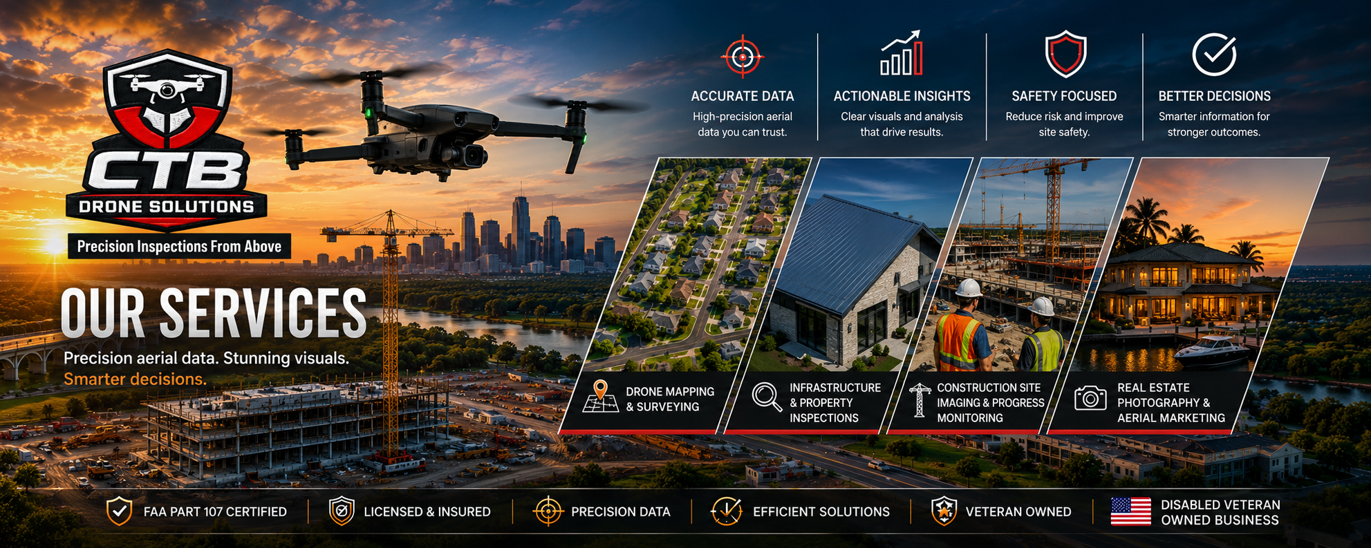
Our Services
At CTB Drone Solutions, we deliver precision aerial data and high-resolution imagery that empower smarter decisions. Using advanced drone technology, we provide accurate, efficient, and cost-effective solutions for construction, real estate, infrastructure, and land development projects.
Drone Mapping & Surveying*
We provide high-accuracy aerial mapping services designed to support planning, development, and analysis. Our drone mapping solutions generate detailed Orthomosaic Maps, 2D and 3D models, and topographic data that help professionals visualize and measure with confidence.
Our mapping services include:
Orthomosaic mapping
3D terrain and surface modeling
Topographic surveys
Volumetric measurements
Progress mapping and site documentation
Our drone mapping services reduce field time, improve safety, and deliver actionable data faster than traditional methods.
Infrastructure & Property Inspections
We conduct safe, efficient drone inspections for residential, commercial, and industrial properties. By capturing detailed aerial imagery, we minimize risk while providing comprehensive visual assessments.
Inspection services include:
Roof inspections
Building façade inspections
Structural assessments
Solar panel inspections
Powe Line Inspections
Hard-to-access area evaluations
Our drone inspections reduce the need for scaffolding or manual access, saving time and improving safety.
Construction Site Imaging & Progress Monitoring
Stay informed at every stage of your project with professional aerial documentation. We provide consistent, high-quality drone imaging that tracks construction progress, enhances communication, and supports project management.
Key benefits:
Real-time project visibility
Progress comparison over time
Stakeholder reporting visuals
Improved planning and coordination
Our aerial imaging helps contractors, developers, and project managers make timely, data-driven decisions.
Real Estate Photography & Aerial Marketing
Elevate property marketing with stunning aerial visuals. We create high-resolution drone photography and cinematic footage that showcase properties from compelling perspectives.
Our real estate media services include:
Aerial property photography
Video walkthroughs and flyovers
Marketing-ready visuals
Highlighting surrounding amenities and landscapes
Our visuals help listings stand out, attract more buyers, and close deals faster.

Contact us
We’d love to hear from you.
Whether you need drone mapping, site inspections, or eye-catching real estate photography, CTB Drone Solutions is here to help. Tell us about your project, and we’ll get back to you as soon as possible with the right solution.
*Disclaimer:
CTB Drone Solutions provides aerial mapping, photogrammetry, and data collection services. While our deliverables may include topographic data, measurements, maps, models, and other survey-support information, CTB Drone Solutions is not a licensed land surveying firm and does not perform services that legally require a licensed Professional Land Surveyor (PLS).
Any mapping, measurements, boundaries, elevations, or other information produced by CTB Drone Solutions that may be used for surveying, engineering, design, permitting, or legal purposes must be independently reviewed, verified, and approved by a licensed Professional Land Surveyor or other appropriately licensed professional as required by applicable laws and regulations. Our deliverables are intended to support planning, analysis, and decision-making and should not be relied upon as a substitute for a licensed survey.